
Introducing the KPA Drone Fleet
Technological Solutions
Over the last few years, drone technology has evolved rapidly, changing how we use drones in the professional environment. The benefits of these innovations are particularly prevalent in the civil engineering field.
There are numerous advantages to using drones in civil engineering:
Project management – Drones assist the internal team and clients track the project life cycle using videos and photos.
Surveying – Photogrammetry and Lidar drone functions can be used to build highly accurate 3-D models. High-quality Orthomosaics, photos comprised of hundreds of smaller overlapping images, can also be produced quickly for design backgrounds or to show the conditions of a job site.
Orthomosaic example:
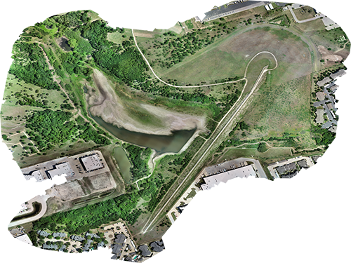
Final Design (As-Builts) – Using imagery and 3-D models, the final design of a project can be verified for accuracy.
Workforce Efficiency – Drone operations only require one or two personnel in place of a survey crew, saving time and money for the firm and the client.
How It Works:
A drone, or Unmanned Aerial Vehicle (UAV), captures aerial data by using a downward-facing camera. The camera photographs the landscape many times during a survey, from multiple angles. This dataset allows the creation of a 3-D model and an Orthomosaic image which is used in the design and planning phases of a project.
Before the invention of drones, human-crewed aircraft or satellites would capture imagery. The flights would occur at a higher altitude resulting in slower data retention and less resolution. These options are also more expensive and dependent on atmospheric conditions such as clear skies.
Traditional topographic surveying requires the manual collection of points, which can be very time-consuming and is prone to human error. The drone is more reliable and expedites this process by collecting millions of points in just minutes. These points can then be filtered down to isolate only the areas needed.
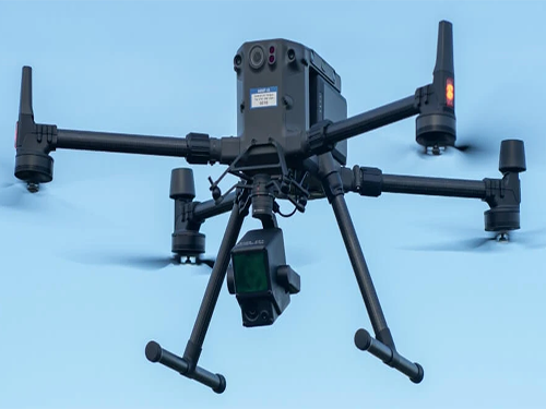
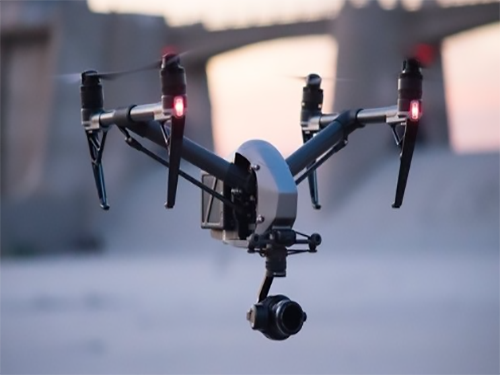
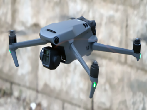
KPA utilizes three drones for our projects, depending on our client’s needs – the DJI Matrice 300 RTK, the DJI Inspire 2, and/or the DJI Mavic 3. All three drones are an asset to the KPA project workflow:
The DJI Matrice 300 RTK (M300) is the surveying workhorse and sets a new standard by combining intelligence with high-performance and unrivaled reliability. With a flight time of up to 55 minutes and a max speed of 51 mph, the M300 efficiently enhances flight performance using DJI’s latest sensors and flight controls. This unit also allows us to automate flight routines to capture consistent results for our project needs efficiently. In addition, the M300 offers obstacle avoidance and aerial awareness, making it one of the safest drones in the sky.
The DJI Inspire 2 is our go-to drone for video and photo project updates. We can fly pre-programmed missions to capture high-resolution imagery on the same flight path through the project lifecycle. This drone can go from 0 to 50 mph in 5 seconds, hit a maximum speed of 58 mph, and includes a dual battery system. The Inspire 2 also provides obstacle avoidance and sensor redundancy, adding protection when flying in challenging missions.
The DJI Mavic 3 is the latest release from DJI and is considered the Swiss Army Knife of drones. This compact package offers multiple cameras, a 46-minute flight time, the ability to withstand high wind speeds, and Complete Omnidirectional Obstacle Sensing. With the Mavic 3, we can capture exceptional project imagery for our clients while experiencing a stable and accurate flight.
This state-of-the-art technology remains a top priority at KPA Engineers and assists in providing highly accurate products and efficiency to our clients.